What’s the difference between a hurricane, cyclone and typhoon?
Natural hazardsArticleApril 28, 20255 min read
Hurricanes, tropical cyclones and typhoons are all destructive windstorms, but how do they differ from one another? Learn more.
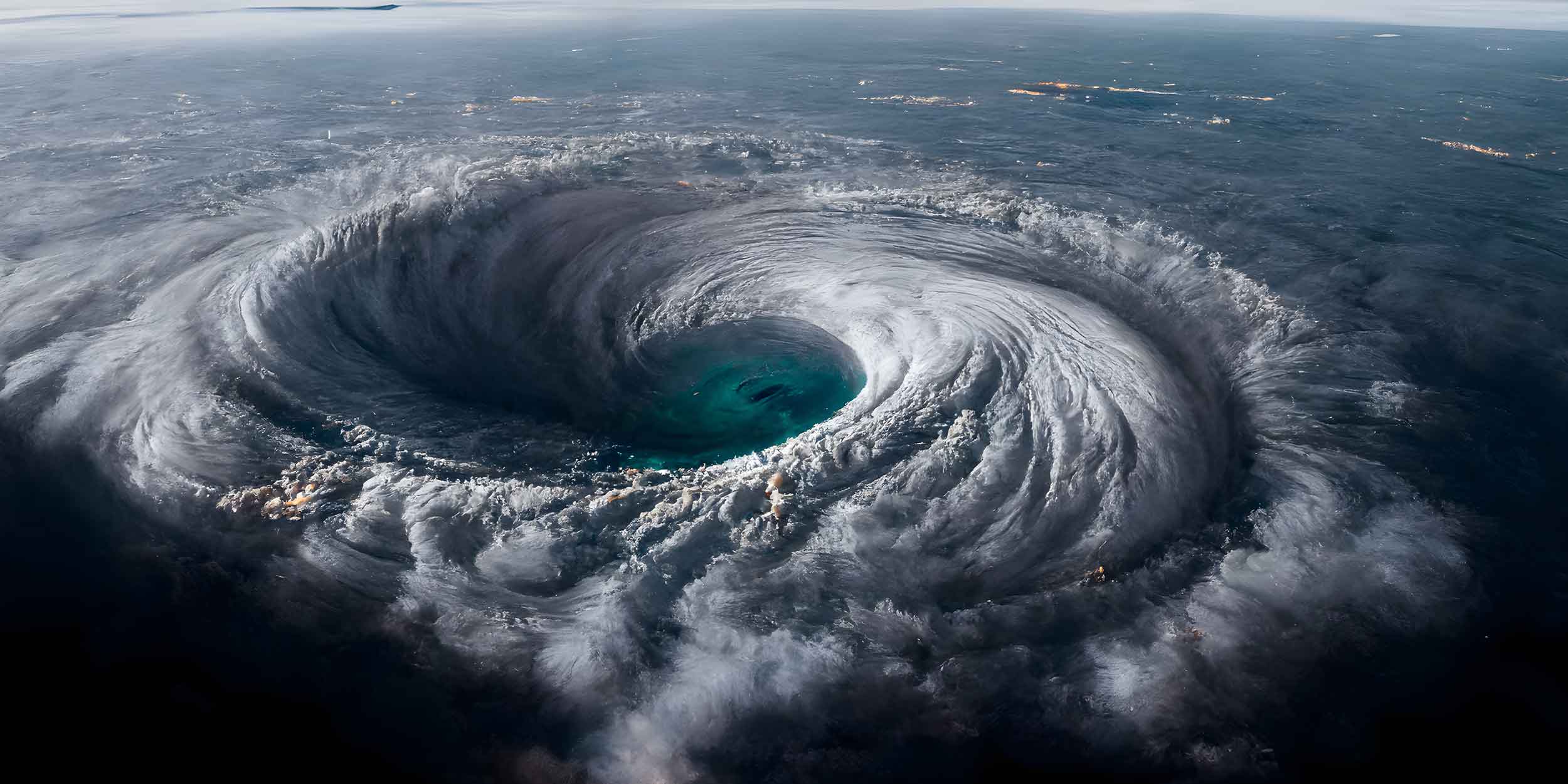
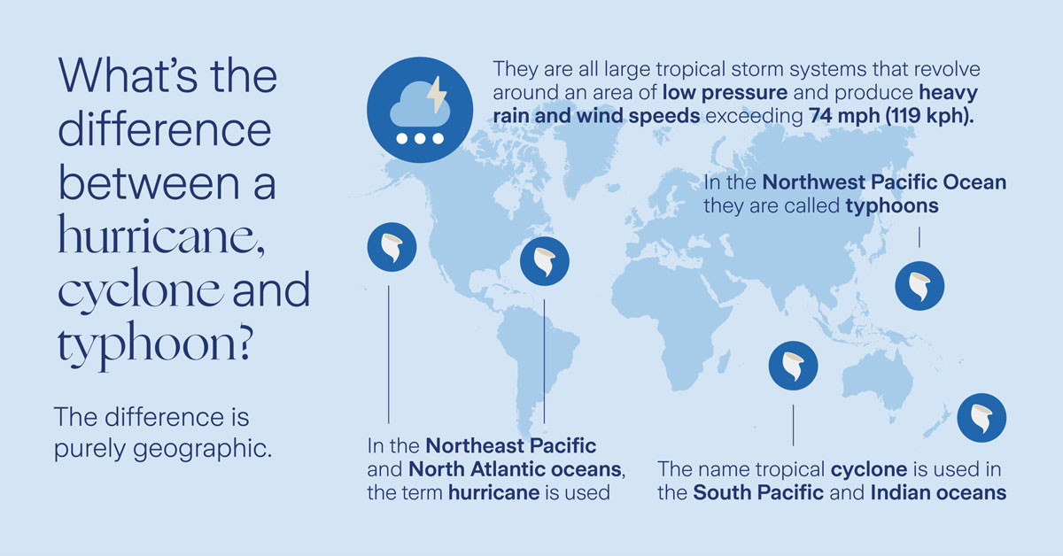
Hurricanes, typhoons, and tropical cyclones are essentially the same weather phenomena. They are large tropical storm systems that revolve around an area of low pressure, producing heavy rain and wind speeds exceeding 74 mph (119 kph).
The difference in their names is purely geographic. In the North Atlantic and Northeast Pacific oceans, the term ‘hurricane’ is used, whereas in the Northwest Pacific Ocean they are called ‘typhoons.’ The name ‘tropical cyclone’ – or sometimes ‘severe tropical cyclone’ or ‘severe cyclonic storm’ – is used in the South Pacific and Indian oceans.
These storm systems are typically five to six miles (8-10 km) high and 300 to 500 miles (480-800 km) wide, although they can be much larger. They usually move forward at speeds of 10-15 mph (16-24 kph) but can travel as fast as 40 mph (64 kph).
Despite different names, all can be incredibly destructive. How you prepare, respond and recover determines your resilience to these powerful windstorms.
Stages of development: tropical disturbances, depressions and storms
Hurricanes, typhoons and tropical cyclones start as a ‘tropical disturbance’ when water vapor from the warm ocean in the tropics or subtropics condenses to form clouds, creating a wind circulation pattern around a center.
If sustained winds increase to 25 mph (40 kph), the storm becomes a ‘tropical depression.’ When wind speeds reach 39 mph (63 kph), it is classified as a ‘tropical storm.’ Above 74 mph (119 kph), it is categorized as either a hurricane, typhoon or tropical cyclone. High winds can cause immense damage, but these windstorms can also trigger other destructive elements like storm surges, torrential rainfall and flooding, which can be even more deadly than the wind itself.
The term ‘superstorm,’ used to describe Superstorm Sandy that struck New York in October 2012, is not an official classification. Sandy was a hurricane but had slowed to a tropical cyclone when it hit the U.S. East Coast. The term ‘superstorm’ was coined up by the media, who also unofficially referred to it as ‘Snowicane Sandy’ (as it was projected to drop snow) and ‘Frankenstorm’ (due to its proximity to Halloween).
Why are hurricanes, cyclones and typhoons given names?
Windstorms like Hurricane Katrina in 2005 or Typhoon Haiyan in 2013 became household names, but why are they named in the first place?
According to Amar Rahman, Global Head of Climate and Sustainability Solutions at Zurich Resilience Solutions, “Hurricanes, typhoons, and tropical cyclones are given short, easily remembered names to reduce confusion when two or more occur simultaneously. It helps meteorologists identify and track them across the oceans and it raises awareness, making it more likely that people will follow guidance during such events.”
When do hurricanes, cyclones and typhoons occur?
- North Atlantic hurricane season: June 1 to November 30.
- Northwest Pacific typhoon season: June through October.
- South Pacific and Australia tropical cyclone season: November to April.
- East Coast of Africa tropical cyclone season: November to April.
- Bay of Bengal and Arabian Sea tropical cyclone season: April to June, and September to November.
It’s important to remember that these are general guidelines, and tropical storms can occur outside of these official seasons.
Do you get hurricanes in Europe?
Technically, Europe doesn’t experience hurricanes. However, the continent can be hit by winds gusting over 74 mph (119 kph), equivalent to a category 1 hurricane, but these are classified as ‘extratropical cyclones’ or ‘European windstorms.’
“These storms form when areas of low atmospheric pressure move in from the North Atlantic,” explains Rahman. “They tend to curve northwards, mostly affecting the UK, Ireland and northern European countries between October and March.”
Though their wind speeds rarely reach hurricane levels, European windstorms can cause immense economic damage, second only to North American hurricanes in terms of insurance losses. For instance, storms Dudley and Eunice, which hit the UK in February 2022, caused estimated insured losses of up to USD 5 billion.
How do tornadoes differ from hurricanes?
A tornado is a completely different weather phenomenon. The only similarity is that tornadoes and hurricanes both contain strong rotating winds that can cause severe damage.
A tornado is a violently spiraling funnel cloud extending from a thunderstorm to the ground. Tornadoes require hot, humid air near the ground and a cool air mass above, along with strong wind velocity at higher altitudes, called ‘wind shear,’ to get them spinning.
Unlike hurricanes, which can be tracked days in advance, tornadoes can appear suddenly with little or no warning. Tornadoes are typically short-lived, often lasting less than 15 minutes, whereas hurricanes can be active for days. Tornadoes are also smaller, usually no more than half a mile (0.8 km) wide, while hurricanes can measure hundreds of miles wide.
However, tornadoes can reach wind speeds of up to 300 mph (483 kph) compared to a maximum of about 200 mph (322 kph) for hurricanes. Tornadoes are also more frequent with the U.S. experiencing about 1,200 tornadoes a year, but only about 10 hurricanes.
Climate Resilience
Our Climate Resilience experts help you identify and manage climate risks, and prepare you for climate reporting.
